")
")
")
")
          |
| Click to enlarge |
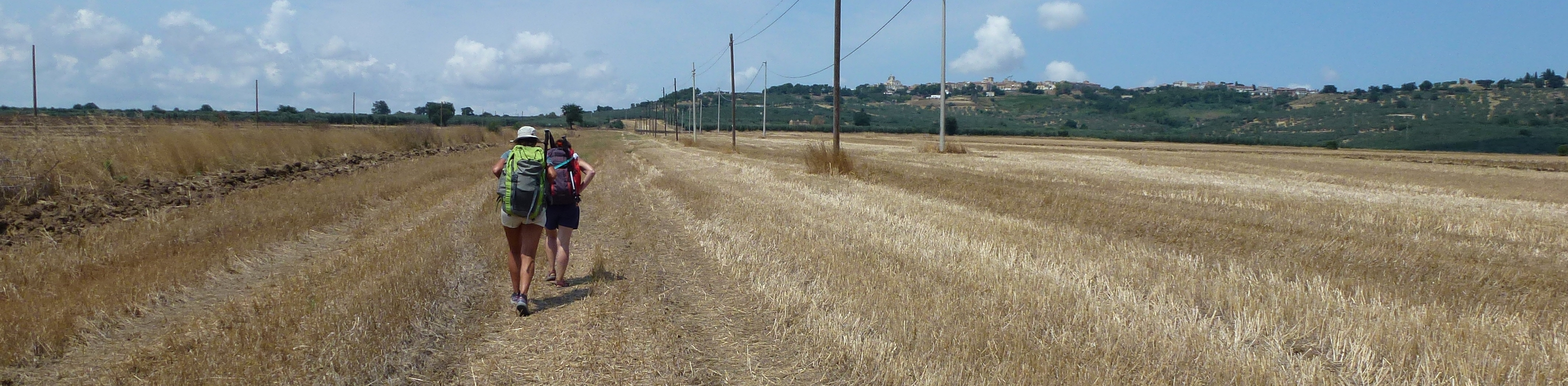
July 25, 2024 - Daily Distance: 26 km - Total Distance: 71 km
Today's stage to Serracapriola (or Serracamoscia, as Silvia calls it!) promises to be quite long. Silvia finds a way to shorten it slightly by taking advantage of the secondary branch Nunziatella - Stignano, but we still have about 26 km ahead of us. For this reason, we set the alarm for 4:00 AM. The B&B where we stayed is spectacular and has a well-equipped kitchen, so we have breakfast with the products we bought the day before.
Despite the early hour, the city is very much alive. On the outskirts, they’re setting up the market, and a bit further on, there’s a flea market with curious and strange items, some of which are difficult to even identify!
A convenient downhill path leads us to the Nunziatella - Stignano branch. From this point on, we’ll walk several kilometers along a single-lane road, alternating between dirt and asphalt. The cool morning air encourages conversation. Along the way, we find white and red stickers marking the "Cammino della Pace": who knows where it leads? In any case, it's nice to see new trails popping up more and more frequently.
After a couple of kilometers, we reach the Tratturo Magno, well-preserved in one of the few remaining intact stretches. Only the small road we’re walking on is accessible, while the rest consists of private lands. However, the long strip of the tratturo is clearly visible on satellite images. Confirming that we’re in the right place, in the middle of a field stands an original tratturo marker with the usual T.R. letters indicating the Tratturo Regio: unfortunately, it will be the only one we come across.
To pass the time, Elena suggests some games to play while we walk. After some complaints from me, I eventually get into the spirit of the competition.
By 8:30 AM, the heat begins to set in, and it’s already been three hours since we started. We stop in the shade of a small hut for a brief break, knowing that the temperatures will continue to rise and the destination is still far away.
It’s time to leave the plateau and descend toward the Fortore Valley. The path I had marked is no longer passable by car due to a landslide, but on foot or by bike, despite the encroaching vegetation, it’s still manageable.
At the foot of the long descent, a dirt road awaits, leading us to the Sanctuary of the Madonna del Ponte, and the "Cammino della Pace" signs reappear. The sanctuary is located at the site where Pope Leo IX’s army clashed with the Norman army (and lost). Nearby, there used to be a tratturo tavern (which we only learned about later) with a sign displaying the toll for crossing the Fortore River: "locati" (transhumant shepherds), priests, and prostitutes were exempt. Armed with this knowledge, we cross the bridge without paying!
After the bridge, the SS16ter awaits us all the way to Serracapriola. As much as possible, we avoid the main road by taking shortcuts through the fields. One final uphill stretch, made particularly grueling by the heat, and we finally conquer the town’s bar!
 |
 |
Track of the day